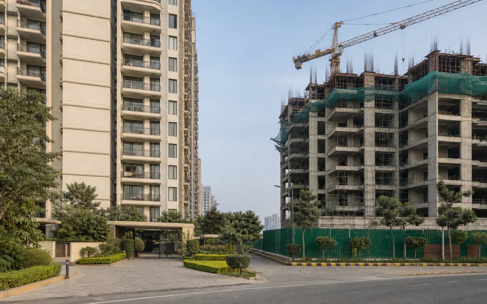
How Noida Infrastructure Should Shape a Property Decision: A Status-First Framework
A disciplined, status-first way to weigh Noida roads, metro lines and the Jewar airport in a property decision, without pricing in anything unbuilt or unverified.
- Author
- Ishaan Khanna
- Category
- Infrastructure
- Date
- June 5, 2026
- Reading time
- 13 min
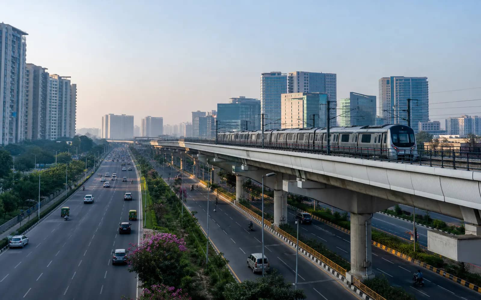
Answer: Infrastructure should change a Noida property decision only when it changes that specific property's real travel time, access, catchment or employment reach, and only to the degree its status is verified. Classify every road, metro line and airport by evidence stage (proposed, approved, tendered, under construction or operational), confirm that stage against the responsible authority on the date you decide, then trace the last-mile route from the exact plot. Corridors you can normally treat as operational, after confirming the specific route, include the DND Flyway, the Noida-Greater Noida Expressway, the Yamuna Expressway, the Delhi Metro Blue and Magenta lines and the NMRC Aqua Line; anything still being built, including the Aqua Line extension, the FNG corridor and the airport's rail and metro connectors, is a dated scenario to verify, never a premium to pay today. Treat the Noida International Airport at Jewar the same way: confirm its current status, live routes and ground-access options directly from the official airport, NIAL and YEIDA sources, and count it only where it demonstrably changes a property's access, not by proximity on a map.
Independent guide: we do not quote live prices, approvals or returns. Verify project-specific facts against current official documents before acting.
Start with the evidence stage, not the announcement
The single most expensive mistake in a Noida property decision is collapsing a five-stage lifecycle into one promised completion. A corridor moves through proposal, approval, tender or award, construction, and only then operation, and each stage carries a very different probability and timeline. A press event or a marketing map tells you a project was announced; it tells you nothing about whether it will change your commute in the years you plan to hold the asset.
Before any infrastructure claim influences your price, write down its stage, the responsible body, and the date you verified it. Governance in this region is split three ways: the NOIDA Authority covers Noida, GNIDA covers Greater Noida, and YEIDA covers the Yamuna Expressway region including the Jewar airport zone, all within Gautam Buddh Nagar district, Uttar Pradesh. A road in one authority's plan is not automatically funded, tendered or built, so treat the announcing body and the funding-and-execution body as separate questions.
Keep a status tag on every corridor and refresh it before each decision. Status changes, and a figure or claim carried forward without a date is a liability, not evidence. When you cannot confirm a stage from an authority source, treat the project as if it does not yet exist for pricing purposes.
Name what is actually operational in Noida today
Some corridors are genuinely operational and can be built into your travel-time maths now, provided you verify the specific route. On the road side these include the DND Flyway into Delhi, the Noida-Greater Noida Expressway, and the Yamuna Expressway running south past Greater Noida toward Agra. On public transport, the Delhi Metro Blue Line reaches into Noida, the Magenta Line connects at Botanical Garden, and the NMRC Aqua Line runs between Noida and Greater Noida.
The Noida International Airport at Jewar is developed in the Yamuna Expressway region under YEIDA and the Noida International Airport project company. Its reported status has moved quickly and has been described differently across sources, which is exactly why you must confirm the current position (whether operations have begun, which routes are live, the capacity, and critically the ground-access options) directly from the official airport, NIAL and YEIDA sources before you assume it shortens anyone's journey. Do not price a plot on a status you have not verified on the date you decide.
Operational status, even once confirmed, is necessary but not sufficient. The airport's dedicated metro and rail connectors were still being built as of mid-2026, so its ground access is largely road-based via the Yamuna Expressway; confirm the current position before relying on it. A property far from that access point, or facing a long feeder journey, may capture little of the benefit, which is exactly why the last-mile test below matters more than headline proximity.
Trace the last-mile connection from the specific property
Regional infrastructure delivers uneven local value, and the difference is decided in the last mile. A property two kilometres from an expressway entry with a clean feeder road is connected; a property the same distance away but behind an unsignalled crossing, a level crossing, or a congested internal road is not. Straight-line distance on a map is the least reliable input you can use.
Walk or drive the actual route from the plot to the corridor's usable access point, at the time of day you would actually travel. Note the junctions, the merge points, the pedestrian and auto-rickshaw conditions to the nearest metro station, and the peak-hour bottlenecks. For a metro benefit, the honest question is not distance to the line but the real door-to-platform time including the feeder leg, which frequently doubles the map estimate.
Record what you observe with a date, because on-ground conditions are decision-relevant experience that no brochure captures. A corridor that looks transformational on paper can be functionally distant for a specific address, and a modest local road can matter more to daily life than a marquee expressway three sectors away.
Convert infrastructure into a specific user outcome
Infrastructure has no abstract value; it has value to a defined user doing a defined thing. Before attaching any weight to a corridor, state who benefits and how. For an office, test whether staff can reach the building on public transport and whether clients can arrive predictably. For retail, test whether the corridor actually enlarges the reachable catchment and improves arrival, or merely lets traffic pass by faster.
For a home, the test is the daily commute, school and healthcare access, and reliability across seasons, not a future headline. For an investor, the discipline is sharper still: identify precisely who would pay more rent or a higher price because of the infrastructure, and why they cannot already get the same outcome elsewhere. If you cannot name that marginal buyer or tenant, the infrastructure is not yet a value driver for your asset.
This user-outcome framing also protects you from double counting. A single corridor often gets credited separately by every project's marketing along its length; the outcome test forces you to ask whether your specific property genuinely captures the benefit or simply sits near something that helps someone else.
Treat future corridors as dated scenarios, never as priced-in benefits
Several high-profile projects remain under construction or in procurement and must be handled as dated scenarios, verified before each decision, not as present benefits. The Aqua Line metro extension from Botanical Garden toward the Sector 142 corridor was reported approved in early 2026 and had not entered service; confirm its current status and alignment on NMRC notifications rather than a sales deck.
The FNG (Faridabad-Noida-Ghaziabad) Expressway remains a partially built, under-construction cross-NCR link whose completion targets have repeatedly moved; verify the current status of the segment relevant to you with the authority before assigning it any weight. The airport's own rail and metro connectors, as noted, were still under construction as of mid-2026. None of these should be folded into today's rent, price or demand narrative.
The rule is simple and non-negotiable: an unbuilt corridor is conditional upside, not a premium you pay now. If a seller or broker prices a plot as though a proposed line already runs past it, that gap is the speculation you are being asked to fund, and it is the first thing to negotiate out.
Model base, delayed and operational scenarios
Because infrastructure timelines slip, evaluate every decision under three cases rather than a single forecast. In the base case, the unbuilt corridor never arrives on your horizon; in the delayed case, it arrives years late; in the operational case, it arrives broadly as planned. The property should be acceptable to you in the base case on its existing, verified access alone.
If a purchase only makes sense in the operational case, you are not buying a property, you are buying a bet on a government project's schedule, which is outside your control. Structuring the decision this way turns future infrastructure into what it actually is: optionality that improves an already-sound decision, rather than the load-bearing reason for it.
Apply the same scenario discipline to holding costs and exit. If your plan to sell or lease at a higher figure depends on a corridor opening, ask what the asset is worth if it opens late or not at all, and whether you can hold comfortably in that base case.
Classify each corridor before it enters your decision
The table below turns the framework into a working checklist. For each corridor, fix its verified status as of your review date, state the one way it could change your specific property, and name the authority where you confirm it. Do not carry any row forward without re-checking its status and date.
| Corridor or project | Status to verify | How it could change your property | Where to confirm |
|---|---|---|---|
| DND Flyway, Noida-Greater Noida Expressway, Yamuna Expressway | Operational (confirm the specific route) | Real road travel time and regional access today | NOIDA, GNIDA, YEIDA and the expressway authority |
| Delhi Metro Blue and Magenta lines, NMRC Aqua Line | Operational (confirm the specific route) | Public-transport access for staff, tenants and visitors | DMRC and NMRC official information |
| Noida International Airport, Jewar | Verify current operational status, live routes and ground access | Regional connectivity where road access genuinely reaches the plot | NIAL, YEIDA and the official airport site |
| Aqua Line extension, Botanical Garden toward Sector 142 | Reported approved (early 2026); not in service; verify current stage | Future metro reach to named sectors, if built | NMRC official notifications |
| FNG (Faridabad-Noida-Ghaziabad) Expressway | Under construction, partial; targets have moved | Future cross-NCR road link, if completed | Relevant authority and state PWD notifications |
| Any project whose value rests on an unbuilt link | Registered on UP RERA? Latest QPR filed? | Whether the promise is even legally and financially underway | UP RERA registration record and QPR |
Verify tenure and cost before infrastructure ever enters the maths
Infrastructure upside is worthless if the underlying title and tenure do not hold. Authority land in Noida and Greater Noida is predominantly leasehold, so before you weigh any corridor, confirm the tenure, the balance lease period, and any transfer or usage restrictions for the specific plot with the allotting authority. A short balance lease or restrictive transfer terms can erase a connectivity gain.
Keep regulatory and cost checks anchored to named primary sources rather than memory. Confirm a project's existence and declared schedule through its UP RERA registration and Quarterly Progress Report; pull the current circle rate for the relevant sub-registrar area from the IGRSUP valuation list on the date you model stamp duty and registration; and read lease rent and transfer charges from the authority's own records. None of these figures should be quoted from a brochure or from this article, because they change and must be dated at the point of use.
Only after title, tenure and cost are verified does an infrastructure scenario deserve a place in your decision. In that order, a corridor becomes a considered upside on a fundamentally sound asset, which is the only way infrastructure should ever move a Noida property decision.
Questions buyers and tenants ask
Does a new expressway or metro line automatically raise nearby Noida property prices?
No, proximity alone does not raise a specific property's value. Access design, the real last-mile route, competing supply, land use, timing and genuine user demand decide whether a corridor benefits a particular plot, so a property can sit near new infrastructure and capture little of it.
Does the Noida International Airport at Jewar make nearby property automatically a good buy?
No, because proximity and even operational status are necessary but not sufficient. Confirm the airport's current status, live routes and ground-access options from the official airport, NIAL and YEIDA sources, remember a property only benefits where road or transit access genuinely reaches it, and never pay a premium for map proximity alone.
Which source should confirm a Noida infrastructure project's status?
Use the responsible authority and dated official documents: NOIDA, GNIDA or YEIDA for area corridors, NMRC and DMRC for metro, and UP RERA for any project whose value depends on the link. Record the status and the date you verified it, and re-check before each decision because status changes.
Should I pay a premium today for a proposed metro extension or the FNG Expressway?
No, an unbuilt or partially built corridor is conditional upside, not a present benefit. Items such as the Aqua Line extension and the FNG Expressway were still under procurement or construction in mid-2026, so treat them as dated scenarios to verify and require the property to make sense without them.
Is authority land near new Noida infrastructure freehold?
No, authority land in Noida and Greater Noida is predominantly leasehold. Confirm the tenure, the balance lease period and any transfer or usage restrictions for the specific plot with the allotting authority, because these can offset or erase a connectivity gain.
How far from a corridor still counts as connected?
There is no fixed distance; connection is decided by the last mile, not the map. A plot with a clean feeder road and a short, reliable door-to-platform or door-to-ramp journey is connected, while a closer plot behind congested internal roads or a difficult crossing may not be.
How to verify this yourself
- Confirm the current operational status, route network and ground-access options of the Noida International Airport at Jewar from NIAL, YEIDA or the official airport site before assuming it changes a specific property's access.
- Trace the actual route, junctions and feeder roads from the exact plot to the corridor's usable access point at peak time, rather than using straight-line map distance.
- Check the status and alignment of any under-construction or approved corridor (Aqua Line extension, FNG Expressway) on NMRC or the relevant authority's notifications, with the date, before assigning it weight.
- For any project whose value rests on an unbuilt link, confirm its UP RERA registration and latest Quarterly Progress Report before crediting the promise.
- Verify the tenure (leasehold status), balance lease period and transfer terms for the specific plot with NOIDA, GNIDA or YEIDA before weighing any infrastructure upside.
- Pull the current circle rate for the relevant sub-registrar area from the IGRSUP valuation list on the date you model stamp duty, and store the retrieval date.
Sources and where to verify
- UP RERA official portal (project, promoter and QPR search)
- IGRSUP: Uttar Pradesh Stamp and Registration portal (circle rate and stamp duty)
- Noida Metro Rail Corporation (NMRC) official site
- YEIDA: Noida International Airport (Jewar) project page
- Noida International Airport official passenger and company information